
Αρχείο:World Map 1689.JPG

Πρωτότυπο αρχείο (4.560 × 3.936 εικονοστοιχεία, μέγεθος αρχείου: 8,59 MB, τύπος MIME: image/jpeg)
Αυτό το αρχείο είναι επιφορτωμένο στα Wikimedia Commons. Μπορείτε μόνο να δείτε την περιγραφή του παρακάτω. Αν θέλετε να την επεξεργαστείτε πηγαίνετε στην αρχική σελίδα περιγραφής του στα Commons. |
|

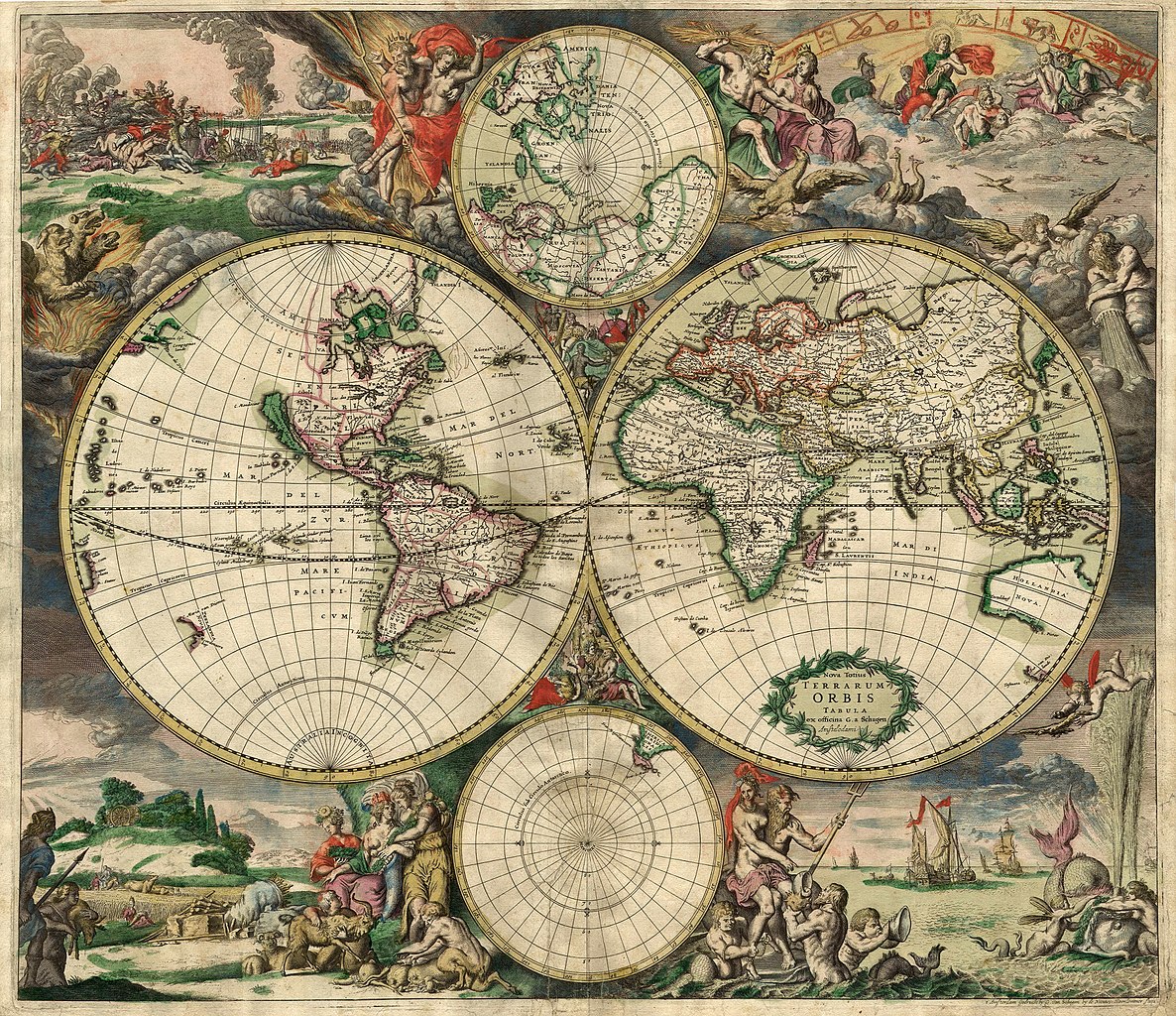
This image was selected as picture of the day on Wikimedia Commons for 7 February 2007. It was captioned as follows: English: An old world map produced in Amsterdam in 1689. Other languages:
Deutsch: Eine 1689 in Amsterdam hergestellte Weltkarte. English: An old world map produced in Amsterdam in 1689. Polski: Mapa świata wyprodukowana w Amsterdamie w roku 1689. Suomi: Hollantilainen maailmankartta vuodelta 1689 Svenska: En gammal världskarta tillverkad i Amsterdam 1689. Winaray: In kahadto nga mapa han kalibutan nga ginhimo ha Amsterdam, 1689. Српски / srpski: Стара карта света направљена у Амстердаму 1689. עברית : מפת עולם משנת 1689 מאמסטרדם |
| This image was selected as a picture of the week on the Persian Wikipedia for the 21ος week, 2011. |
Σύνοψη
| Περιγραφή |
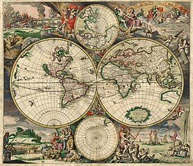
Nederlands: Nova totius terrarum orbis tabula Amstelodami, ex officina G. a Schagen (1682), t'Amsterdam Gedruckt by G. van Schagen, by de Nieuwe Haerlemmer Sluys.
English: World map - Produced in Amsterdam
First edition : 1689. Original size : 48.3 x 56.0 cm. Produced using copper engraving. Extremely rare set of maps, only known in one other example in the Amsterdam University. No copies in American libraries. In original hand color. Français : Carte du monde - Créée à Amsterdam Première édition : 1689. Taille originale : 48,3 x 56,0 cm. Eau forte. |
| Ημερομηνία | This edition 1689 |
| Πηγή | This image is made up of six separate images downloaded from Helmink.com and stitched together. |
| Δημιουργός | |
| Άδεια (Επαναχρησιμοποίηση αυτού του αρχείου) |
Public Domain |
| Georeferencing | If inappropriate please set warp_status = skip to hide. |
| άλλες εκδόσεις | Image:World Map 1689-smaller.jpg (smaller filesize version, easier to download) |
.JPG)
Αδειοδότηση
|
Αυτό το έργο είναι κοινό κτήμα στη χώρα προέλευσής του και άλλες χώρες και περιοχές όπου η διάρκεια πνευματικών δικαιωμάτων είναι όσο η ζωή του δημιουργού και μέχρι 70 χρόνια μετά ή λιγότερο.
| |
| Αυτό το αρχείο έχει χαρακτηριστεί ως απαλλαγμένο από γνωστούς περιορισμούς βάσει της νομοθεσίας περί πνευματικής ιδιοκτησίας, περιλαμβανομένων όλων των συναφών και συγγενικών δικαιωμάτων. | |
Ιστορικό αρχείου
Πατήστε σε μια ημερομηνία/ώρα για να δείτε το αρχείο όπως εμφανιζόταν εκείνη την χρονική στιγμή.
| Ημερομηνία/Ώρα | Μικρογραφία | Διαστάσεις | Χρήστης | Σχόλιο | |
|---|---|---|---|---|---|
| τρέχον | 00:59, 4 Σεπτεμβρίου 2013 | | 4.560 × 3.936 (8,59 MB) | Crisco 1492 | Reverted to version as of 12:34, 16 October 2010 |
| 00:47, 4 Σεπτεμβρίου 2013 |  | 4.560 × 3.936 (19,56 MB) | Crisco 1492 | Reverted to version as of 01:01, 30 November 2006 Per Commons:Overwriting existing files, do not overwrite featured images | |
| 12:34, 16 Οκτωβρίου 2010 |  | 4.560 × 3.936 (8,59 MB) | Brandmeister~commonswiki | slight adjustment | |
| 01:01, 30 Νοεμβρίου 2006 |  | 4.560 × 3.936 (19,56 MB) | Tarawneh | == Summary == {{Information |Description= World map - Produced in Amsterdam<br> FIRST edition : 1689 <br> Original size : 48.3 x 56.0 cm <br> Produced using copper engraving |Source= scanned copy |Date= This edition 1689 |Author= van Schagen |Permission |
Χρήση αρχείου
Δεν υπάρχουν σελίδες που χρησιμοποιούν αυτό το αρχείο.
Καθολική χρήση αρχείου
Τα ακόλουθα άλλα wiki χρησιμοποιούν αυτό το αρχείο:
- Χρήση σε af.wikipedia.org
- Χρήση σε ar.wikipedia.org
- Χρήση σε ba.wikipedia.org
- Χρήση σε bg.wikipedia.org
- Χρήση σε bg.wikiquote.org
- Χρήση σε bjn.wikipedia.org
- Χρήση σε bn.wikipedia.org
- Χρήση σε bs.wikipedia.org
- Χρήση σε ca.wikipedia.org
- Χρήση σε ce.wikipedia.org
- Χρήση σε crh.wikipedia.org
- Χρήση σε cs.wikipedia.org
- Χρήση σε cv.wikipedia.org
- Χρήση σε de.wikipedia.org
- Χρήση σε el.wikipedia.org
Δείτε περισσότερη καθολική χρήση αυτού του αρχείου.